County Kerry, South-West Ireland
Dingle Peninsula
The quieter Kerry drive: how to do the Slea Head loop in a day, where to base yourself in Dingle town, real distances and why this beats the Ring of Kerry for first-timers.
In short
Dingle Peninsula at a glance
The Dingle Peninsula is the Ring of Kerry's quieter, shorter cousin: a single 47km loop, the Slea Head Drive, that strings together beehive huts, the Blasket-island viewpoints and some of Ireland's best beaches, all reachable from one base in Dingle town. It's a Gaeltacht, so road signs are in Irish only — Daingean Uí Chúis is Dingle, An Daingean the town — and it sits an hour's drive west of Killarney. You need a car: public transport to Slea Head is effectively nil. Most people give it a single full day on a longer Kerry trip, but Dingle town is characterful enough to justify two nights of its own.
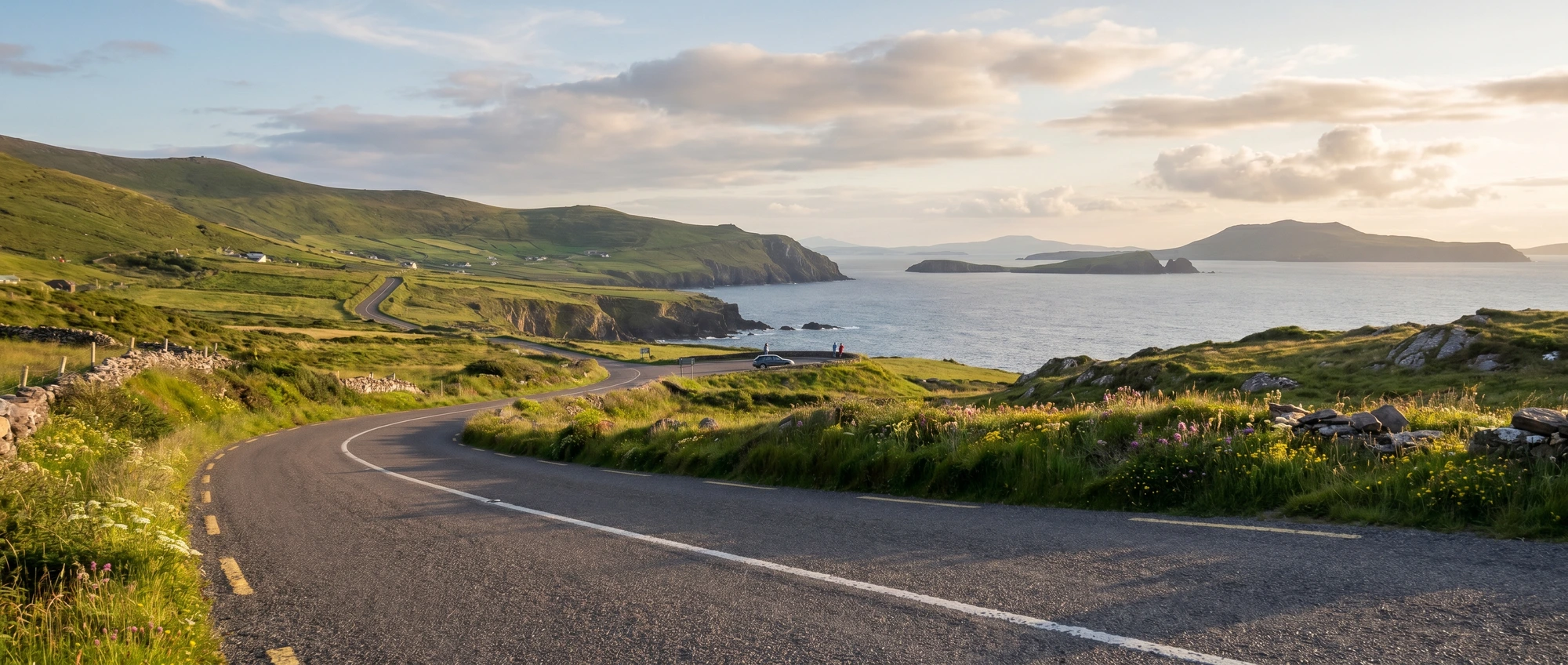
Everyone arrives in Kerry braced to do the Ring of Kerry, and a fair few of them would have a better day on the Dingle Peninsula instead. The reason is scale: the Ring is a 180km commitment that turns into a long day of driving with stops crammed in around the coach timetable, while Dingle’s Slea Head Drive is a 47km loop you can actually savour — pull over for the beehive huts, walk down to Coumeenoole strand, stand at the crucifix viewpoint looking across to the Blasket Islands, and still be back in town for the evening’s music. It is the more concentrated, less trafficked version of the same west-Kerry magic.
The classic mistake is treating it as a half-day add-on from a Killarney hotel — you end up driving an hour each way to drive a loop you then have to rush. If the peninsula is the point, sleep in Dingle town, not Killarney, and give Slea Head a whole day. Two small things catch first-timers out: this is a Gaeltacht, so the signs west of Dingle are in Irish only and your sat-nav and the road sign won’t always agree, and the loop is genuinely single-track in places, so drive it clockwise to follow the coaches rather than meet them, and don’t take the Connor Pass on the way out if the cloud is down.
The route
A relaxed two-night plan that gives Slea Head the full day it deserves rather than the rushed half-day most Killarney-based visitors get. Distances are short — the whole loop is 47km — but the single-track sections, photo stops and farm traffic mean it eats a full day, so don't pile it onto a Ring of Kerry day.
-
Day 1
Arrive via Inch Beach, settle in Dingle
Drive in from Killarney (~1h10) or Kerry Airport (~50 min), stopping at the 5km sweep of Inch Beach — you can drive onto the firm sand — and Annascaul for a pint at the South Pole Inn. Check into Dingle town, then spend the evening on the harbour and in a trad-music pub like Foxy John's or Dick Mack's.
-
Day 2
The Slea Head Drive
Give the full 47km loop a whole day, clockwise out of Dingle: the Dunbeg fort and beehive huts, the Slea Head crucifix viewpoint over the Blasket Islands, Coumeenoole beach (the 'Ryan's Daughter' strand) and the Gallarus Oratory, a 1,200-year-old dry-stone church. Allow 3–4 hours of actual driving with stops; cars only — coaches can't all fit the narrow western stretch.
-
Day 3
Connor Pass and onward
Leave over the Connor Pass, Ireland's highest tarmac road at 456m — a single-track climb with passing bays and a waterfall stop, not for nervous drivers in fog. It drops you towards Tralee for the road back to Killarney or north to the Wild Atlantic Way, or return the easy valley road if the pass is clouded in.
Where to base yourself
Pick one or two bases rather than moving every night.
Dingle town
££ mid-rangeThe obvious and best base — a compact, walkable fishing town with the peninsula's only real cluster of restaurants, B&Bs and the famous music pubs, all within five minutes of the harbour. Rooms are limited and summer prices spike, so book months ahead for July and August. Park once and walk.
Best for: First-timers, trad music, walkable evenings
Ventry / Slea Head road
££ mid-rangeScattered guesthouses and self-catering cottages along the western loop itself, with beach access and Blasket-island views from the window. Quieter and more scenic than the town, but you'll drive 10–15 minutes for dinner and there's no nightlife — a trade-off worth making if the views are the point.
Best for: Beach mornings, peace, self-catering
Inch / Annascaul (eastern end)
£ valueThe cheaper, easier-to-book eastern side near Inch Beach, handy if you're combining the peninsula with Killarney and the Ring of Kerry rather than making Dingle the focus. Less atmospheric than the town but better value and a shorter hop back to the Killarney hub.
Best for: Budget, combining with the Ring of Kerry
Getting around Dingle Peninsula
A hire car is essentially mandatory here — the Slea Head Drive has no scheduled bus, and Local Link runs only a handful of daily services between Dingle and Tralee, useless for the loop itself. Pick the car up at Kerry Airport (Farranfore) or Cork Airport rather than keeping a Dublin car parked, and drive the loop clockwise so you're going the same way as the tour coaches on the single-track western cliffs instead of meeting them head-on. The roads are narrow, hedge-lined and shared with farm traffic and cyclists, so pad your times and pull into the passing bays. Ireland drives on the left like the UK, so there's no wrong-side anxiety. The Connor Pass is single-track and exposed — skip it in thick fog and take the valley road back to Tralee instead. If you genuinely can't drive, a half- or full-day Slea Head minibus tour from Dingle town is the only practical way to see the loop.
Book the essentials
Where to stay
Tours & tickets
Airport transfers
Car hire
Stay connected
Dingle Peninsula FAQs
Is the Dingle Peninsula better than the Ring of Kerry?
Do you need a car for the Dingle Peninsula?
How long do you need on the Dingle Peninsula?
Ready to book?
Compare car hire